OTHER ROUTES |
| DOWNLOAD THE GUIDEBOOK>>> |
|---|
Hiking in Menorca
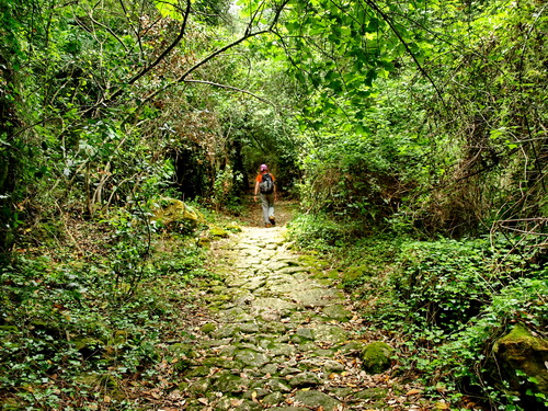
Walking is the best way to enjoy the varied landscape of the island: You will see the farmhouses in the middle of fields criss-crossed by drystone walls. Along the way you will find cattle huts, water cisterns, sandstone quarries, lime kilns and watchtowers. In recent years, the opening of coastal paths, the signposting of public trails and the clearing of the Camí de Cavalls have increased remarkably the possibilities for hiking in Menorca. Due to the numerous private properties, on some walks you will have to go back the way you came, or call a taxi. The routes described below as day-hikes include the most beautiful stages of Camí de Cavalls (2, 5, 6, 7, 8, 12, 13, 14, 15, 16 and 19) which are explained in the section ‘Long distance trail - GR 223’.
A.- Around Maó A1.- From Es Castell to Maó Time: 1hr 30min (one way)/ Height climbed: 50 m/ Degree of difficulty: medium/ Cyclability: medium- easy Walk along the southern shore of the magnificent inlet of Port de Maó.
Access to the starting point: Take the road Me-6 from Es Castell to Sant Lluís and turn left towards ‘Sol del Este’. After the street veers left, you find at nº 19 a narrow path that leads to the coast. Follow it and go to the right when you reach the cliffs. Go over a wall to a cove (5min) with superb views over Port de Maó and its islands. Go back the same way but follow the coastline to Cala Pedrera (10min), and from there take a narrow path above the cliffs to the pretty Cales Fonts (10min). Walk along the port (5min) to reach Passeig de Sta. Àgueda (5min) and Carrer de Sant Ignasi where you take the first on the right to Cala Corb. Instead of going down to the seafront, turn left on Carrer de Cala Corb and, after a few meters, go to the right on Carrer Stuart. At its end, in an open field, walk first in the same direction and then go towards the coast. When the footpath veers left, go down on a narrow path to the small harbour of Es Fonduco from where you walk along the coastal street towards Maó. A4.- From Cala de Sant Esteve to Trebalúger Circular route/ Time: 2hr 30min/ Height climbed: 50m/ Degree of difficulty: medium/ Cyclability: medium-easy (difficult at some stony sections). Beautiful narrow footpaths lead to the interesting archaeological site ‘Talaiot de Trebalúger’.
Access to the starting point: Set off from the car park of Fort Marlsborough, located before reaching Cala de Sant Esteve. Cross the road and walk on a cobbled footpath to Cala de Sant Esteve. Go to the right and, after 150 meters, turn right uphill and follow the Camí de Cavalls until you reach a wide track (10min, to the left is ‘Villa Eugenia’) where you go to the right. At the Camí de Binissaïda (700m) turn right and, after 400 meters (where the road veers right) left taking the ‘Camí Fosc’. From there follow the signposted cycle route (towards Sant Lluís) some 1500m to the junction with ‘Camí de Rafalet’ where you keep straight on. Shortly afterwards, go to the left on Camí de sa Torre and, at its end, to the right. Take the first road on the left to visit the Talaiot de Trebalúger. Go back to the last fork and turn left to the Me-6 which you follow for several meters to the right. Take the ‘Camí de Trepucó a Trebalúger’ on your left that narrows and is very stony. When it gets wider, go to the right on a dirt track which ends in one of the most fascinating foothpaths of the island. At the track Camí de Biniatap turn left for a couple of meters and right on a wide path where you keep straight on. At the Me-6, walk further in the same direction, take the first road on the right and, at the next junction, go to the right to the car park.
A5.- From Cala de Sant Esteve to Punta Prima Circular route/ Time: 5hr 30min/ Height climbed: 200m / Degree of difficulty: medium/ Cyclability: medium- easy (difficult between Punta Prima and Cala d’Alcalfar). Varied hike along narrow and pretty footpaths which go by a watchtower, an archaeological site and a beautiful cove.
Access to the starting point: See route A4. Follow route A4 to the Talaiot de Trebalúger (1hr). From there, go back to the last fork, turn right, leave the Camí de sa Torre to your left and keep straight on. Take the unpaved Camí de Trebaluget which comes out onto Camí de Rafaletó where you leave the cycle route and go to the left. At the next turnoff, take the Camí de s’Olivera to the right until the road from Sant Lluís to Punta Prima (45min) that you cross straight on. Follow the cycle route to Biniancolla (1hr) and, from there, walk towards the coastlinking, after 250 meters, with the stage 18 of Camí de Cavalls (described in its section). Turn left to Son Ganxo, leave the street and walk along the coast to the northern edge of Punta Prima (30min). From there, take stage 19 of Camí de Cavalls to Cala de Sant Esteve (2hr 15min). Don’t miss the detour to Caló de Rafalet.
B.- You will find these routes on the ‘Mountain biking’ section
C.- The Nature Park of S’Albufera des Grau - Cap de Favàritx Since 1995, the nature park has protected, 5000 hectares of wetlands, forests and beaches. The park also includes the Cap de Favàritx where you can admire the oldest rocks of the island. The access to the Information Centre is from the road Me-5 (Maó- Es Grau, K. 3.5).
C1.- Llimpa’s Route (40min/ 1.7km). From the information centre, follow the road to its end where you can also park. Take the dirt track on your right that leads you to a beautiful viewpoint over the lagoon.
C2.- Santa Madrona’s Route (1hr). From the information centre, follow the road to its end where you can also park. Take the closed dirt track on your left and, after 200 meters, turn right to a bird watching hut. From there, go back some 100 meters, turn right and, at the next turnoff, again to the right on a wide track which you follow until another bird watching spot. Keep straight on and take a narrow path to the left that joins up with the dirt track. Go to the right to the car park.
C3.- Sa Gola’s Route (45min, 1.7km). It starts at K. 6 of the Me-5, near Es Grau. After the bridge, turn left to a viewpoint (5min), go back to the forested path (5min) and turn left. When you reach the beach (15min), go to the right to the village of Es Grau.
C4.- From Es Grau to Cap de Favàritx (2hr 45min, one way): Follow stage 2 of Camí de Cavalls.
D- From Cala Tirant to Sanitja Time: 1hr 30min (one way)/ Height climbed: 100m/ Degree of difficulty: medium/ Cyclability: medium Follow the first section of stage 5 of Camí de Cavalls. When you reach the road, you could go to the right for 2 kilometres to the lighthouse at Cavalleria.
G- From Algaiarens to Cala Morell Time: 1hr 50min (one way)/ Height climbed: 150m/ Degree of difficulty: medium-low/ Cyclability: medium-difficult Follow stage 8 of Camí de Cavalls. The most interesting section is the first one to Codolar de Biniatram.
N- Sant Tomàs - Son Bou - Sant Tomàs Circular route/ Time: 3hr/ Height climbed: 60m / Degree of difficulty: medium- low/ Cyclability: medium This hike combines a rocky coastal path, the wetlands of Son Bou and the longest beach of Menorca Access to the starting point: At the entrance roundabout of Sant Tomàs, turn left and park at the end of the street near Hotel Victoria Playa.
N1.- Sant Tomàs - Son Bou: Walk to the seaside, go to the left and follow stage 15 of Camí de Cavalls.
N2.- Son Bou - Sant Tomàs: From the car park at the entrance of Son Bou, walk for 50 meters along the road (towards Alaior) and take the first street on the right. At the next turnoff, go to the left, pass the ruins of an old church and walk along the beach to the right. At its end, keep straight on, following the Camí de Cavalls to Sant Tomàs.
P- Son Bou - Cap de ses Penyes Time: 45 min/ Height climbed: 50m / Degree of difficulty: medium- low/ Cyclability: medium- difficult Walk to a beautiful viewpoint over the longest beach of the island Access to the starting point: At the entrance of Son Bou, there is a car park on the right hand side. From the car park, follow the Camí de Cavalls walking for 50 meters on the road (towards Alaior) and taking the first street on the right. After 20 meters, turn left and go up to a pass (10min). Go to the right uphill along a wide path and, at its end (10min), take a narrow path to the top of the cape. Enjoy the superb views over Cala de Llucalari and Platja de Son Bou before going back down the same way you came.
S- Punta Prima - Caló de Rafalet - Cala de Sant Esteve. Return along interior footpaths Circular route/ Time: 5hr 30 min/ Height climbed: 200 m / Degree of difficulty: medium/ Cyclability: medium- easy (difficult between Punta Prima and Cala Alcalfar) Varied hike on coastal and interior paths. Caló de Rafalet is worth visiting Take stage 19 of Camí de Cavalls from Punta Prima to Cala de Sant Esteve (see the section on the GR 223). From there, go back to the last junction (to the left is Villa Eugenia), turn right and follow route A5 of this section.
Mountain biking
With a mountain bike, you can cycle along most of the hikes described in the previous section. However, please walk your bike when going the wrong way down a one way street.
B1.- Visit of Maó 6km/ Height climbed: 100m / Cyclability: easy This route combines the highlights of Maó (Port, historic centre) with the pretty chapel of Sant Joan des Vergers. Set off from Plaça Abu Umar (last roundabout of the Ronda de Maó on the way to Es Castell). Take Avinguda Fort de l’Eau, keep straight on at the first roundabout and at the next turnoff, turn right. Follow Passeig Marítim (which is located above the cliffs) and at Plaça de la Miranda, head towards the town centre where you come to Plaça d’Espanya. Here, you can explore the Església del Carme church, the nearby streets Sant Crist, Hannover, Església and the Parc des Freginal, a nice garden. From Plaça d’Espanya cycle towards Plaça de la Conquesta and Plaça de la Constitució where you take carrer d’Isabel II. Go around the church of Sant Francesc (which houses the Museu de Menorca) and downhill on Costa de ses Piques. Turn left at the seaside, cycle along the road Me-7 and at the roundabout, take the third exit (Camí de Baix de Sant Joan) to the chapel. Turn left on Camí de Dalt, cross the ring road and, at carrer Fornells, turn left. When the street veers right, take a flight of steps to the left and at Costa de ses Piques, turn the left. Turn left again at the seaside and cycle along it as far as possible. Return at Es Fonduco and take Costa de Cala Figuera or Corea to reach the starting point.
B2.- Gràcia – Trepucó - Torelló- Sant Joan des Vergers- Gràcia 12km/ Height climbed: 100m / Cyclability: medium- easy Along paths, tracks and roads, visit the most interesting places around Maó: the chapels of Gràcia and Sant Joan, the archaelogical sites of Trepucó and Torelló and the hamlet of Llucmaçanes. From the Ronda de Maó, turn off the roundabout in the direction of ‘Cementeri /Trepucó’ and pass the Ermita de Gràcia (besides the cemetery). After 700 meters, turn left and shortly afterwards, turn right. Pass the ruins of Trepucó and at the junction (400 m), turn right and at the next one (700m), right again. Follow the road from Sant Lluís to Maó and turn left towards the restaurant ‘El Picadero’. Cycle along a track and turn right on Camí de Darrere Malbúger Vell. Ignore the forks, cross a road and take Camí d’en Claudis. Cross the access road to Llucmaçanes (worthy detour), the Me-12 and the Me-14. An unpaved track leads to a paved one where you go for several meters to the right and turn left on Camí de Torelló. Pass by the tall talaiot de Torellonet Vell and the old church Fornàs de Torelló and at the next junction, turn right, leaving the bike route to the left. At the Me-1, keep straight on and follow a beautiful path. At its end, turn right and ignoring all turnoffs, come to the Ermita de Sant Joan des Vergers. In front of it, go uphill on Camí de Dalt de Sant Joan, cross a road and once inside Maó, take the streets Santa Victòria and sa Rovellada de Dalt. When you reach carrer de ses Moreres, take it for several meters to the left and turn right on carrer Cós de Gràcia which leads back to the starting point.
B3.- Gràcia – Trepucó – Llucmaçanes – Torret – Trebalúger - Gràcia 16km/ Height climbed: 100 m / Cyclability: medium- easy Discover the interesting area between Maó and Sant Lluís where you find the archaelogical sites of Trepucó, Binissafúller and Trebalúger. From the Ronda de Maó, turn off the roundabout towards ‘Cementeri/Trepucó’ and pass the Ermita de Gràcia (besides the cemetery). After 700 meters, turn left and shortly afterwards, turn right. Pass the ruins of Trepucó and at the junction (400 m), turn right and at the next one (700m), right again. Follow the road from Sant Lluís to Maó and turn left towards the restaurant ‘El Picadero’. Follow the track, ignoring all forks, to Llucmaçanes, where you go towards the church. To the right of the church cycle along Camí de Biniati, a beautiful path which leads onto a paved road. Turn left and when it veers left, carry straight on, on a narrow path (to the left of the ‘Son Marroxet’ sign) that ends in a road where you should turn left. At the archaeological site of Binissafullet, turn left (towards Sant Lluís) and, after 1200 meters turn right towards Torret. Cross the road from Sant Lluis to Punta Prima and take the Camí des Consell. When it veers left, turn right on Camí de sa Sínia to the end where you cycle to the left along Camí de ses Cases Velles. Follow the bike route towards Es Castell (right) as far as the Camí de sa Torre (worthy detour to talaiot de Trebalúger keeping straight on for 50 meters and turning left). Turn right and at the end of Camí de sa Torre onto Camí de Rafalet, cross the road and cycle along a narrow footpath. At the paved road, turn right and at a crossroads, left towards Maó.
B4.- Route of the archaeological sites: Gràcia – Trepucó – Torellonet - Talatí de Dalt - Torralba d’en Salort - Alaior- Maó 30km/ Height climbed: 300m / Cyclability: medium- easy Through magnificent landscapes, this route leads to some of the most important archaeological sites of the island. Follow route B2 to Camí de Torelló. At the junction, located 800 meters beyond the car park of the Basílica Paleocristiana, turn left following a bike route towards Alaior. An unpaved track leads to a paved one where you turn left, passing by the archaeological site of Talatí de Dalt. At the next junction, turn right and once near the Me-1 to the left. Shortly afterwards, take an unpaved track which leads to the road from Cala en Porter to Alaior. Turn right, passing the ruins of Torralba d’en Salort and in Alaior, go to the cemetery where you take the Camí d’en Kane back to Maó
B5.- Camí d’Addaia - S’Hort des Lleó 6km/ Height climbed: 50m/ Cyclability: medium- easy For a longer route, start in Es Grau and follow the second stage of Camí de Cavalls. At the Favàritx’s road, turn left and, after 5 kilometres, find the Camí d’Addaia on the right. Access to the starting point: From the Me-7, take the Cf-1 (Favàritx’s road) and after 2300 meters, find the Camí d’Addaia on your left. Take it until you reach the locked gate of Mongofra Vell where you turn left on Camí de Cavalls. Cross the abandoned evaporation ponds and follow the inlet of Port d’Addaia as far as you like.
B6.- Around Ciutadella 20km/ Height climbed: 100m / Cyclability: easy. Visit of the most interesting places around Ciutadella: Punta Nati, Cala en Blanes, the inlet of the Port and the historic centre. From the car park besides the Cementeri Vell, go towards the centre taking carrer Sant Antoni Mª Claret and Camí de Maó. At Avinguda de la Constitució (Contramurada) turn right and cycle along carrer Francesc de Borja Moll and Camí de Son Salomó till the ring road where you should carry straight on. The road to the lighthouse of Punta Nati goes through an interesting landscape riddled with drystone cattle huts. Go back to the ring road and turn right to Cala en Blanes. At its entrance roundabout, turn left on a street that leads to the pretty Camí de sa Farola. After the ferry station, go down to the harbour where you take the Costa des Moll uphill to Plaça des Born. Turn right to the fortress Castell de Sant Nicolau and left along Passeig Marítim. At the roundabout, take the bike lane of carrer Mallorca which leads to Plaça des Pins. Turn right to Plaça des Born where you see the City hall on the left and three palaces on the right. Between two of them, the carrer Major des Born starts and crosses the historic centre. Along it, you find the Cathedral and around it, other churches and palaces, the market and the Museu Diocesà. At its end, take Camí de Maó which leads back to Cementeri Vell.
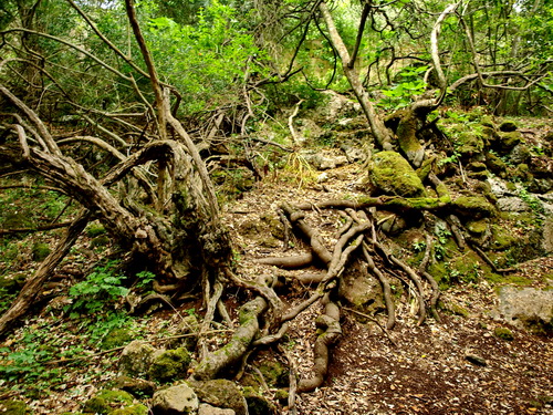
B7.- Ciutadella - Cala en Turqueta - Cala Galdana - Barranc d’Algendar - Ciutadella 40km/ Height climbed: 300m / Cyclability: medium- easy You will enjoy two of the most magnificent landscapes on the island: The coves of the southwest coast and the gorges of Barranc d’Algendar. From the car park besides the Cementeri Vell, take carrer d’Alfons V to the roundabout of Camí de Sant Joan de Missa which leads to the ring road and to the chapel. From there, cycle along the paved road to the car park of Cala en Turqueta and the track to the beach. Follow stage 13 of Camí de Cavalls to Cala Galdana and then, take the road Me-22 towards Ferreries. Shortly before the roundabout of the Me-1, turn left on Camí Reial, signposted as a bike route. Cross the magnificent gorge ofBarranc d’Algendar with a permanent stream and go by the archaeological site of Torretrencada and the interesting quarries “Pedreres de s’Hostal” (worthy detours). Shortly afterwards, drive underneath the ring road and keep straight on to the Cementeri Vell.
B8.- Es Migjorn Gran – Binigaus - Cala Galdana 14km/ Height climbed: 400m / Cyclability: medium This route crosses forests and gorges on the way to Cala Galdana. Follow route M (‘Hiking in Menorca’ section) to Platges de Binigaus. Before arriving to the beach, turn right on Camí de Cavalls. Through holm oak and pine forests, the path crosses some tracks, gorges and the cove of Cala Mitjana to reach the tourist resort of Cala Galdana. From there, you could cycle further to Cala Macarella along Camí de Cavalls nd then directly to Ciutadella, where you could take the signposted bike route to Ferreries.
B9.- Son Mercer de Baix - Cova des Moro 8km (go and back)/ Height climbed: 120m / Cyclability: medium- easy Short drive to an archaeological site located at a beautiful viewpoint. Access to the starting point: Take the Me-18 from Ferreries towards Es Migjorn Gran. Between K.1 and K.2,turn right on a dirt track (signed ‘Son Mercer de Baix, Cova des Moro’). Climb along it, passing the farm of Son Mercer de Dalt and shortly after Son Mercer de Baix, turn right. Walk uphill behind the ruins to enjoy the view over Barranc de sa Cova. |
|
Castle of Santa Àgueda
__________________________
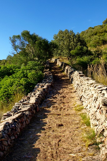
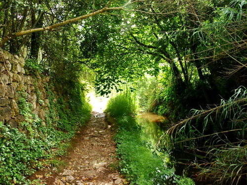
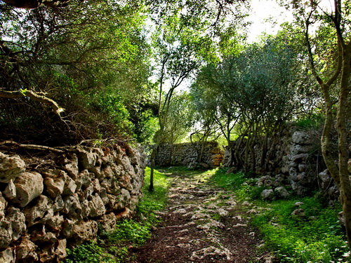
The path "Camí Reial" in the Algendar's gorge
Pas d'en Revull (Barranc d'Algendar)
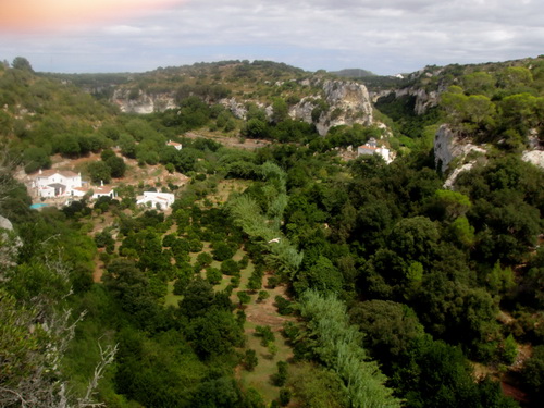
Barranc d'Algendar
-------------------------------------------------------------
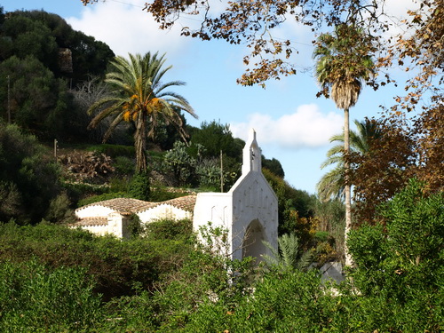
Sant Joan des Vergers- Maó
-------------------------------------------------
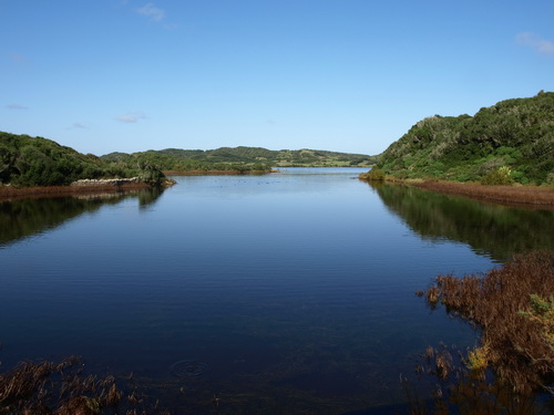
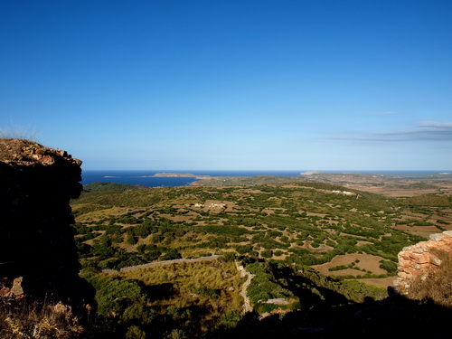
S'Albufera des Grau
-------------------------------------
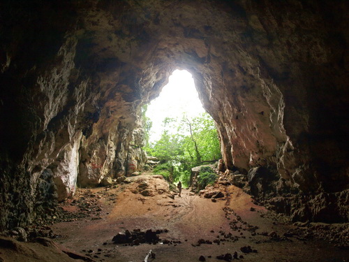
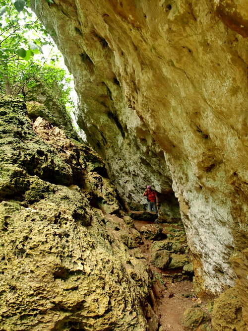
Cova des Coloms